|
|
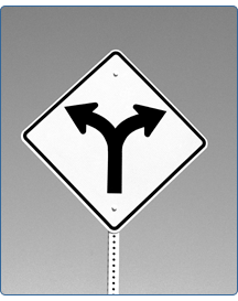
Which way? Psychologist
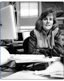
investigates how we get where were going Can you get there from here? That’s what Holly Taylor wants to know. More precisely, she wants to know how you tried to get there, and what would make it easier to find your way. Taylor, associate professor of psychology, is investigating the relationship between “verbal and pictorial representations of geographic information” and how the two can be integrated—in other words, whether people prefer to find their way using maps or verbal directions and to what extent they use a combination of both.
Ultimately, Taylor and a colleague hope to devise a navigation system that can be used on a Personal Digital Assistant (PDA) to help people find maps and verbal directions with a level of detail customized for each user and each occasion. “As a behavioral scientist, I’m thinking about how people experience spatial cognition and how the brain processes it, versus the way a computer programmer or cartographer [would represent such concepts],” Taylor said. Taylor is collaborating on the project with Mike Worboys of the University of Maine at Orono and the National Center for Geographic Information and Analysis, a research consortium. “Mike is a mathematician who is interested in geographic information processing, and I’m a cognitive psychologist by training,” Taylor said. “It’s an interdisciplinary meeting of the minds.” The project “looks at levels of detail: What level of detail do you need to present to people to successfully find their way, combining both maps and verbal directions? The idea is to be able to put it on a Palm Pilot. There’s not a lot of space or resolution there, so you need to find the most effective ways to combine and match levels of detail in the least amount of space possible,” Taylor said. Both Tufts and the University of Maine have received $85,000 grants from the National Science Foundation for the project. To match levels of detail between maps and directions, Tufts students will be given maps of college campuses and asked to provide verbal directions based on them. The students also will be given sets of verbal directions and asked to draw maps based on those. Worboys will build a navigation system based on the data collected. Then, Taylor and Worboys will see whether people can use this information to get around and do so more effectively with carefully matched maps and directions. Study participants will be asked to navigate on campuses with which they are unfamiliar so that previous experience and bias don’t interfere. The subjects will be able to switch back and forth between various levels of detail—whether on a map, written text or spoken instructions. “This could also, for example, be used by a blind person,” Taylor said. “Then the map part would not be so useful, but that person would be able to switch to a very detailed level on the verbal information, which would be voice-activated. We have that in mind.” While there are already some commercial products that offer maps and verbal directions via the Internet, “they are not flexible enough,” Taylor said. Most people have a preference for their method of wayfinding, Taylor said. Some people are “map people,” while others are befuddled by maps and prefer spoken or written directions.
To some extent, Taylor said, this preference is inborn. “I would argue that some of it is innate,” she said. “There is a genetic component. Some brains are more verbal. Some are wired to be more spatial.” But through exposure and practice—especially during childhood—people can, to some extent, “learn” to be more comfortable with other types of data. Conventional wisdom holds that men are more comfortable with maps, women with verbal directions. In her research with Tufts students, Taylor says those stereotypes don’t hold: The Tufts population is so “high-achieving” that both men and women are skilled at spatial tasks, she said. Even in the general population, “gender differences are not as obvious as they used to be,” she said. “Little boys used to have freer reign over where they would go [compared to little girls]; boys used to get more spatial toys. To some extent, that’s still true, but it’s less pigeonholed.” Case in point: As a young girl, Taylor used to go flying with her father. “I would be expected to get the maps, chart the course, the checkpoints. I was exposed to spatial tasks. That’s part of the way I got interested in issues of spatial cognition.” |
|
|
|